Our proprietary PSAI platform is always evolving and now incorporates an advanced tornado tracking feature to enhance our weather map's capabilities. This new layer is designed to offer detailed insights into tornado events, facilitating targeted marketing efforts through platforms like Facebook.
Get notifications of tornados and other storm events by installing the PSAI app today!
Let's delve into the critical aspects of tornado data processing and the meticulous ground surveys conducted by the National Weather Service (NWS), which form the backbone of this innovative feature.
The Tornado Tracking Feature: An Overview
The tornado tracking layer on our platform operates in three distinct states:
- Tornado Warnings: Displayed over county outlines, these warnings (issued by the NWS) remain active for five days or until replaced by official tornado path data.
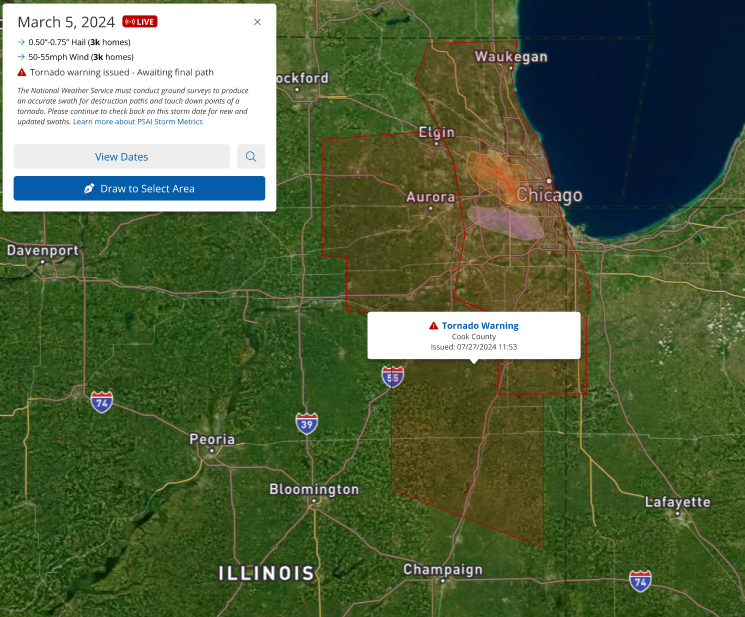
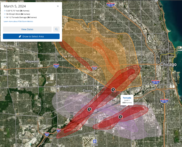
- Official Tornado Paths: These swaths overlay the map, providing detailed information based on the Enhanced Fujita (EF) Scale, ranging from 0 (least severe) to 5 (most severe). The paths are depicted with gradient layers corresponding to the tornado's severity. If the final tornado path is available after five days, the tornado warning will be replaced, and the EF level for the tornado will also be displayed.
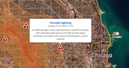
- Tornado Sightings: Icons representing reported tornado sightings appear at the exact locations of these reports, offering real-time insights into ongoing events. Learn More.
The Importance of NWS Data Processing
Following a tornado event, the NWS embarks on a thorough process to gather and analyze data to understand the tornado's impact fully. This process typically spans 2–3 days but can extend over a week for significant tornado outbreaks. These surveys are crucial for understanding the tornado's path, width, duration, and intensity, which are subsequently reflected on our platform.
Our platform's historical path data extends back to 2015, with select events from as far back as the notable outbreak on April 27, 2011, being included. This comprehensive database ensures that users have access to accurate and detailed historical tornado paths to inform their strategies.
The Role of Ground Surveys
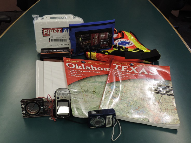
Ground surveys conducted by NWS meteorologists are pivotal in reconstructing a tornado's lifecycle. Equipped with a suite of technological tools—including GPS units, cell phones, laptops with specialized software, digital cameras, and detailed maps—the teams are prepared to assess the extent of tornado damage accurately and assign the EF rating. This rigorous process involves determining the tornado's initial touchdown, path, and the extent of damage, which can vary significantly depending on the construction quality of affected structures.
The Enhanced Fujita Scale: Decoding Tornado Intensity
Historically, tornado intensity was measured using the Fujita Scale, which was revised to the Enhanced Fujita (EF) Scale in February 2007 to address some of the original scale's shortcomings, such as not accounting for the quality of building construction. The EF Scale provides a more accurate assessment of tornado strength, with ratings from EF-0 to EF-5 based on wind speeds and resulting damage:
- EF-0: 65-85 mph (Light damage)
- EF-1: 86-110 mph (Moderate damage)
- EF-2: 111-135 mph (Considerable damage)
- EF-3: 136-165 mph (Severe damage)
- EF-4: 166-200 mph (Devastating damage)
- EF-5: Over 200 mph (Incredible damage)
Conducting a Damage Assessment
Upon reaching the affected area, survey teams first determine the tornado's starting and ending points, width, and the timeline of its path. They then seek the most severe damage points to assign a rating accurately. This involves using 28 specific damage indicators*, ranging from residential homes to commercial buildings and natural structures like trees. Each indicator corresponds to typical construction features that, along with the extent of damage observed, help the team determine the tornado's intensity.
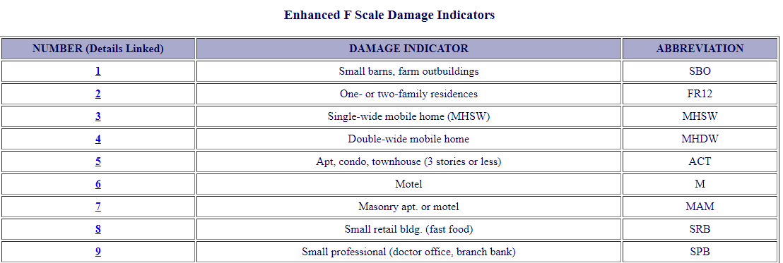
*The 9 damage indicators shown above are the most valuable to exterior remodelers.
For instance, if a tornado significantly damages a residential home but leaves the walls standing, the team assesses the construction quality, damage degree, and assigns an EF rating based on established criteria. This meticulous process ensures that each tornado is accurately classified, providing valuable data for our platform.
Empower Your Decisions with Advanced Tornado Tracking
With our advanced tornado tracking feature, you have the power to make informed decisions that protect and advance your interests. If you have questions or can't find the tornado data you need, our team is ready to help with personalized support and manual report generation. Reach out anytime—we're here to ensure you have the insights you need to navigate the complexities of weather impacts on your marketing strategies effectively.
Learn more about tornados in PSAI Weather with these resources: