The PSAI Weather map provides up-to-date information on storms across the entire country—allowing you to target high-value storm opportunities based on your company's areas served. For the greatest success with your storm campaign, we recommend following the best practices below.
Target a Large-Enough Area
While our storm data is extremely precise and can show you storm-hit homes at the individual level, it's not the best idea to target extremely small geographic areas. The reason for this is that your storm ads must gain enough traction on Facebook in order to go live.
For example, the storm below may look quite large—but in reality, it only covers only 23 houses, which is unlikely to gain traction and see success as a Facebook ad. It is simply too few households.
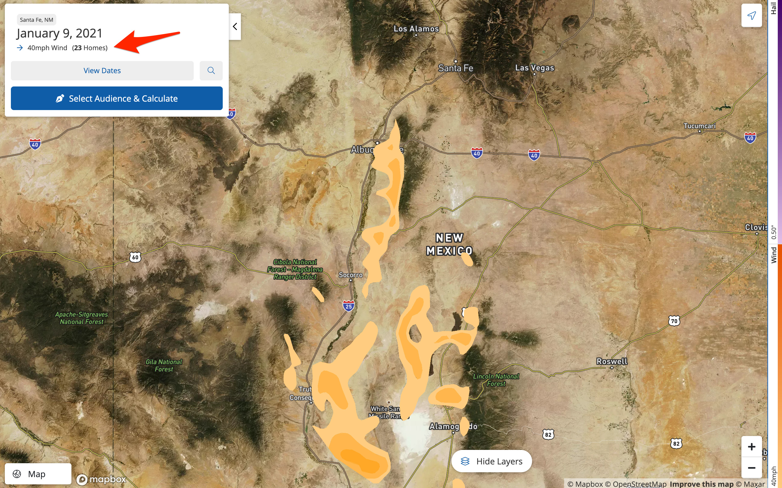
Remember that you can always check the top left panel to find out exactly how many homes are affected by the current storm you're viewing.
While the exact number may depend on your market and strategy, we generally recommend targeting storm areas of at least 1,000 households.
Learn more about storm campaign sizes in these related resources:
- How Large of an Area Should I Target for My Storm Campaign?
- What Does Facebook Mean by "In Learning"?
Draw More Than One Shape, If Necessary
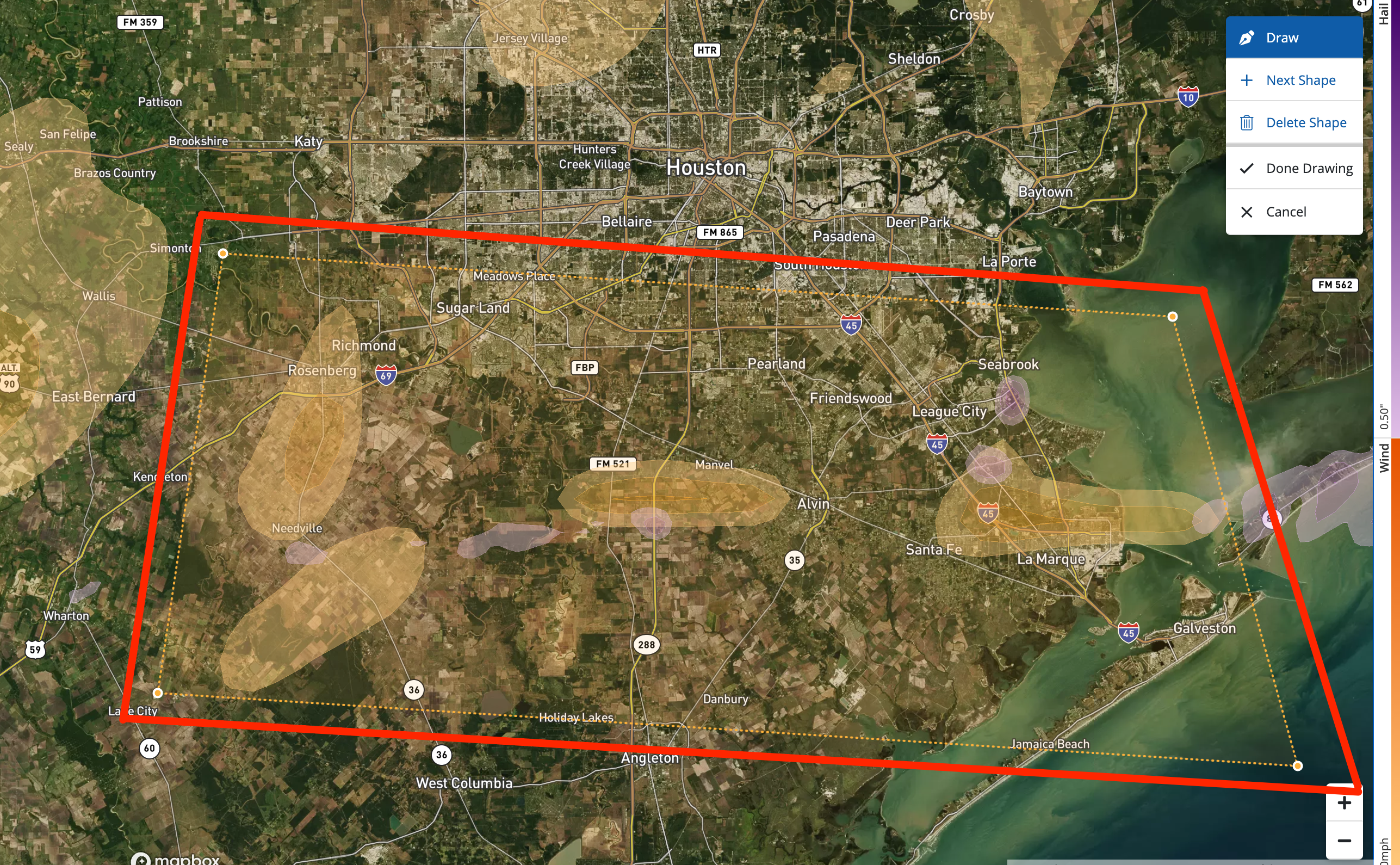
On the Weather map, you can create shapes of any size. However, you'll get the best results by drawing multiple shapes over specific areas—rather than one large shape spanning across a huge geographic area.
There are several reasons for this:
- We're processing a huge amount of data for you, so the smaller and more refined the shapes are, the faster your target audience will load.
- Keeping the shapes very close around each storm ensures the most precise targeting as we calculate the households within the shape.
- Too large of a shape may cause the Weather map to time out, as it is simply too much data to input into a single request.
The shape below, for example, is quite large and spread out, which can make it difficult to process.
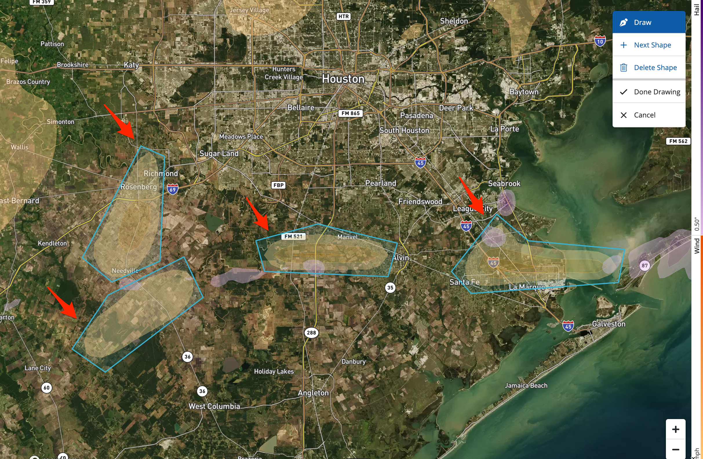
However, we can quickly improve the accuracy and speed of the tool by dividing this into multiple shapes on the Weather map.
Don't know how to create more than one shape? Learn how to draw multiple shapes here.
Draw Closely Around the Storm Swaths
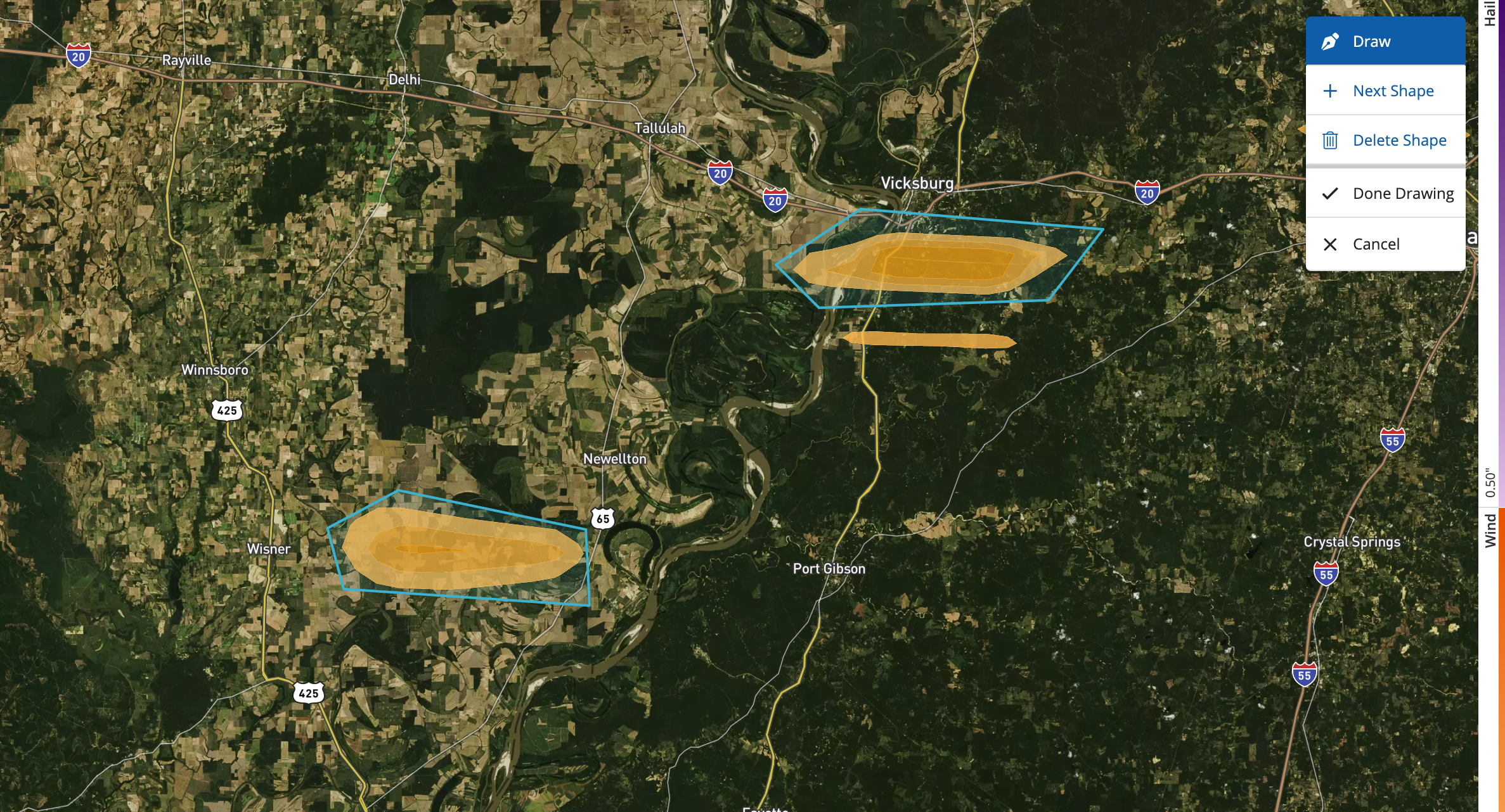
Going hand in hand with the previous best practice, it's always best to draw closely around the storm swaths that you're targeting. The closer you stay to the storm swath boundaries, the more accurate your target audience will be.
In the example below, we've drawn two distinct shapes rather than one spanning both shapes.
Launch Just One Storm Campaign per Date
One of the biggest benefits to drawing multiple shapes on the Weather map is that you can combine these smaller storm swaths into the same Facebook ad campaign. Again, Facebook requires a certain level of "traction" among users to activate your ad—so combining smaller storms from the same date into the same campaign can get your ad active more quickly.
Learn more about combining storms into the same campaign.
Submit a Ticket If You Need Help
If you are having any kind of issue using the PSAI Weather map, please don't hesitate to contact us! The quickest way to get help is through the Help Desk. Use this link to submit a Support ticket, or start by opening the Help widget in the bottom right corner of the screen.